
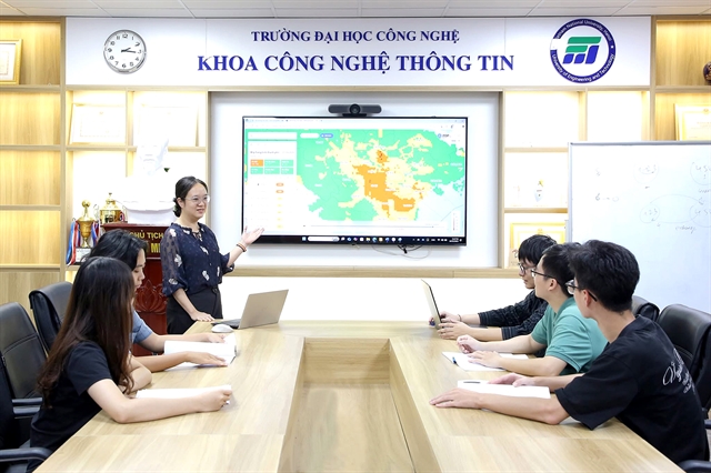
A group of scientists from the University of Engineering and Technology, Việt Nam National University, Hà Nội have developed the country’s first artificial intelligence (AI)-based air quality forecasting system. Việt Nam News reporter Khánh Dương speaks with Associate Professor Nguyễn Thị Nhật Thanh, the lead researcher, about the system’s application in the early prediction of air quality in the capital.
Could you give an overview of the HanoiAir application and its key features in forecasting air quality in Hà Nội and surrounding provinces and cities? What indicators, maps or warnings does the application provide to users?
HanoiAir is an application that provides air quality index forecasts for the next nine days in Hà Nội and neighbouring provinces and cities.
The app offers forecast maps of the Vietnamese Air Quality Index (VN AQI) and PM2.5 concentrations on a 1x1km grid, updated daily.
The HanoiAir version for the community includes features such as forecast maps of VN AQI and PM2.5 for Hà Nội and nearby areas for the current day, air quality trends for 126 wards and communes in Hà Nội over the following nine days and rankings of wards and communes based on air quality levels.
The version for managers provides more detailed forecast information down to a 1sq.km area, with advanced features for data display, retrieval and analysis compared with the community version, supporting environmental management.
HanoiAir uses an AI model that runs automatically and updates forecast results daily.
What advantages does HanoiAir’s air quality forecasting model have compared with the traditional monitoring station system of the environmental authority? In particular, how do they differ in terms of spatial coverage, early forecasting capability and update frequency?
Traditional monitoring stations provide hourly observations of VN AQI and concentrations of major pollutants such as PM2.5, PM10, sulphur dioxide, nitrogen dioxide, carbon monoxide and ozone at locations surrounding the stations, reflecting air quality at the present time.
In contrast, HanoiAir provides daily forecast maps of VN AQI and PM2.5 for the current day and the following nine days on a 1x1km grid covering Hà Nội and neighbouring provinces.
The main difference is that monitoring stations supply measured air quality data for specific locations at present and past times, while HanoiAir delivers forecast maps for upcoming days across the entire city and surrounding localities.
The Ministry of Agriculture and Environment is also operating a national VN AQI forecasting system. While it offers similar forecasting functions, its forecast horizon is limited to two days and at provincial scale. Therefore, it does not provide as long-term, up to 10 days, or as high-resolution, down to 1sq.km, forecasts as HanoiAir.
How can policymakers, experts and the public use HanoiAir in management, research and public health protection? Can HanoiAir data support policymaking or early warnings of severe pollution periods?
Residents can use HanoiAir directly to understand air quality conditions in their living and working areas in the coming days, enabling them to plan adaptive measures to protect themselves and their families.
For example, during prolonged and severe pollution episodes, protective measures such as wearing certified masks outdoors, using public transport, limiting outdoor exercise during peak pollution periods and using air purifiers at home are necessary, especially for vulnerable groups such as children, the elderly and pregnant women.
Authorities can use HanoiAir to issue early warnings of severe air pollution waves and implement local emission reduction measures during these periods.
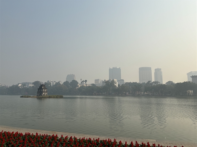
On November 25, 2025, the Ministry of Agriculture and Environment issued an official dispatch requesting seven northern provinces and cities to respond proactively, as air pollution was forecast to increase sharply in late November and early December.
This is an example of Government action based on air quality forecasts.
Managers can also use HanoiAir to identify pollution hotspots within their jurisdictions.
For researchers, forecast results can be used to observe and analyse the causes of air pollution, providing accurate advice to policymakers on emission management strategies.
The information can also help assess the impacts of air pollution on public health and the economy.
In the future, does the HanoiAir team plan to expand forecasting models and applications into other related fields such as traffic management, urban planning, public health, climate change or smart city development?
In addition to air pollution research, the HanoiAir team is developing a range of science and technology products in other fields, including forecasting storm formation and development, rainfall estimation and prediction, land cover and land use monitoring and agricultural applications.
We expect that more of the team’s research outcomes will be applied in practice, effectively serving the public, the scientific community and policymakers.
(VNS)