
Vietnam and China have agreed to strengthen hydrological data sharing during the flood season and exchanges of advanced forecasting technologies.
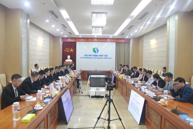
The Vietnam Meteorological and Hydrological Administration (VNMHA) under the Ministry of Agriculture and Environment had a working session in Hanoi on November 16 with a high-level delegation from China’s Ministry of Water Resources, led by Vice Minister Liu Dongshun.
At the event, the two sides signed the Minutes of Meeting on an emergency information-sharing mechanism for transboundary rivers. The document formalised key technical agreements reached by experts from the two countries, notably the conditions for activating emergency information provision at two critical locations in the river basins. At Lao Cai station in Vietnam, the activation threshold is a flow rate of 4,000 cu.m per second, while at Ping’er station in China, it is 2,500 cu.m per second. Once activated, information will be exchanged hourly.
Speaking at the working session, Hoang Duc Cuong, VNMHA Deputy Director stressed that Vietnam and China are neighbouring countries linked by the basins of major transboundary rivers, including the Red River (Yuan River) and the Bang Giang-Ky Cung River (Zuo River).
Amid the increasingly severe impacts of climate change, maintaining timely hydrological information sharing under the Memorandum of Understanding (MoU) signed in December 2023, together with close coordination during major floods in recent years, has provided clear evidence of mutual support. This cooperation has directly helped protect lives and property in border areas of both countries.
In response, Liu affirmed that hydrological information sharing is the longest-standing area of cooperation and has delivered some of the most practical results between the water resources and hydrological management agencies of the two countries.
He expressed particular thanks to his Vietnamese counterparts for their timely support in flood prevention and control in recent years. A notable example occurred in late August, during floods triggered by Typhoon Narra. When major flooding hit the Zuo River basin, Vietnam immediately activated its emergency response mechanism following a request from China and doubled the frequency of upstream hydrological monitoring data provision, from four to eight times a day. This swift coordination gave Chinese authorities more time to forecast flooding along the Zuo River and make accurate and safe decisions on flood management.
During the annual flood season from May 15 to October 31, the two sides have consistently exchanged data four times a day at designated stations, increasing the frequency to eight times a day during exceptionally severe floods, such as those in October 2025 and August 2026. In addition to using FTP servers to exchange data in CSV format and applying strict data verification procedures, they have made flexible use of rapid communication channels such as WeChat and Zalo to verify figures in real time when unusual weather conditions occur.
Regarding technological development, Hoang Van Dai, Deputy Director of the National Centre for Hydro-Meteorological Forecasting, said Vietnam has automated most of its rainfall and water-level monitoring equipment, with data transmitted via satellites and mobile telecommunications. The country is also implementing its 2021-2030 network development plan, which aims to build 37 new hydrological stations in transboundary river basins, increasing the total from 109 to 146.
In forecasting, Vietnam has integrated advanced hydrological mathematical models with Geographic Information System (GIS) technology, enabling it to provide warnings of major floods an average of two to three days in advance, with bulletins issued every six hours during flood emergencies./.
(VNA)